

Trekking > The Ausangate Circuit 6d/5n


Trip Notes


Difficulty: Moderate to difficult
Duration: 6 days, 5 nights
Distance: 74 km (46 miles)
When to go: Best from April to October
Altitudes: 3800 meters to 5165 meters (12,500 feet to 17,000 feet) 2 to 3 days acclimatization required
Temperatures: Between -10ºC (night) and 25ºC (day)
Highlights:

Duration: 6 days, 5 nights
Distance: 74 km (46 miles)
When to go: Best from April to October
Altitudes: 3800 meters to 5165 meters (12,500 feet to 17,000 feet) 2 to 3 days acclimatization required
Temperatures: Between -10ºC (night) and 25ºC (day)
Highlights:
- Make a complete circuit around the Mt. Ausangate massif, the tallest mountain the Vilcanota Mountain Range!
- 6 days, 5 nights of scenic trekking
- Snow-capped peaks, expansive glaciers, hot springs and pristine glacier lakes
- Herds of llamas and alpacas, and native peoples in their traditional way of life
- Reach altitudes exceeding 5,000 meters or 16,900 feet!
- All 4x4 transfers (Day 1 and Day 6)
- Bilingual Guide (Trekking expert)
- Cooking setup
- All meals (15 total – 5 breakfast, 5 lunches, 5 dinners)
- Horses to carry all equipment, personal belongings, food and fuel
- Duffle bag for your belongings
- Cooks, trekking assistant, horsemen
- Tents and mattresses for camping
- Dining tent
- Toilet Tent
- Boiled drinking water
- Bottled Water (although we supply you with boiled water to fill your personal bottles)
- Sleeping Bags ($25 for 5 nights)
- Trekking Poles ($20 for 6 days)
- Extra snacks (Energy bars, granola, etc.)
- Backpack ($20 for 6 days)
- Hot springs entry fee (S/5 Peruvian Soles approx. $2)
- Optional tips for crew, guide, cook and horseman
- Daypack
- Six or seven changes of clothes and warm clothing (layers)
- T-shirts and trekking pants for warmer days
- Thermal gloves, scarf, wool socks, wool hats for cold nights (can reach -10ºC)
- Down sleeping bag for -5ºC
- Rain jacket or poncho
- Hiking or trekking boots (worn-in)
- Flashlight and/or headlamp with extra batteries
- Camera
- Hat and sunglasses
- Sunscreen
- Personal medical kit
- Insect repellent
- Toilet paper and small towel
- Snacks: Candy or energy bars, granola, chocolate, etc.
- Water bottle and sterilizing tablets/water filter
- Swimsuit (if you want to go to the hot springs along the way)
- Cash in Peruvian Soles or $US
- Original passport
- Walking stick or poles (Suggested)
- 2 liter water bottle
- Good sun screen (the sun is very strong here during the day)
- A very good down sleeping bag and warm clothes.


Travel Resources


The Ausangate Circuit 6d/5n
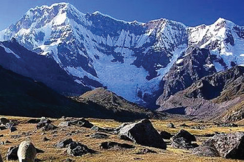
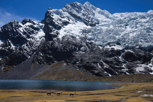
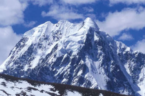
The highest mountain in the Vilcanota Mountain Range, Ausangate stands at an impressive 6385 meters (20,950 feet). It is considered sacred by the local peoples as one of the ancient Incan “Apus” and is a central pilgrimage destination for the Quechua people. In this amazing trekking circuit, you will enjoy spectacular mountain scenery, snow-capped peaks, expansive glaciers, hot springs, pristine glacier lakes, herds of llamas and alpacas, picturesque villages, and traditional Quechua people. This moderate to challenging trek takes you all the way around the massif of Mt. Ausangate and over several high passes above 5000 meters (16,400 feet) – with no climbing required.Tour Itinerary
Day 1
Cusco – Tinqui Village – Upis Hot Springs
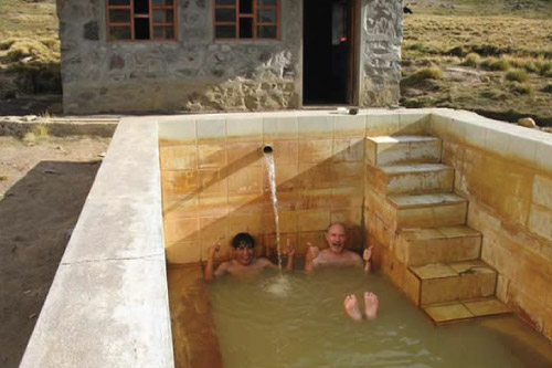
Early departure from your hotel or hostel in Cusco at 6:30 AM. We will drive 3 hours on a new highway to a village called “Tinqui” which resides on the high plain “Altiplano” surrounding Cusco. From here, we will follow a path that climbs gently towards the northwest face of the massive Mt. Ausangate. We will pass by fields and scattered farmhouses, as well as herds of llamas and alpacas. We will camp at Upis, located at 4435 meters (14,952 feet), surrounded by snow-capped mountains that make up the Ausangate massif. With little elevation gain, this is a good day to get acclimated for the following days. As an added bonus, there are hot springs in Upis where we can enjoy a refreshing soak at the end of the day.Maximum Altitude: 4435 meters or 14,592 feet
Minimum Altitude: 3350 meters or 11,021 feet
Distance Travelled: 16 km or 10 miles
Approximate Hiking Time: 6 - 7 hours
Day 2
Upis to Jatun Pucacocha
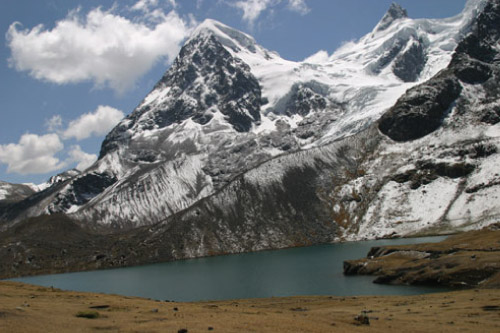
Today we will reach the first of three passes on our trek. After breakfast, we will climb for approximately 3 hours towards Arapa Pass (4757 meters or 15,650 feet). From the pass, we start to traverse across an arid hillside and then start to descend, sometimes quite steeply, into a valley of pristine glacial lakes and waterfalls. We will make our way towards our campsite by Lake Jatun Pucacocha (4585 meters or 15,084 feet), beautifully nestled below the massive glaciers of Mt. Ausangate.Maximum Altitude: 4757 meters or 15,650 feet
Minimum Altitude: 4585 meters or 15,084 feet
Distance Travelled: 17 km or 10.5 miles
Approximate Hiking Time: 6 Hours
Day 3
Jatun Pucacocha to Huchuy Finaya/Pampacancha
One of the most beautiful days of our trek, today we will climb steadily to Ausangate Pass (4850 meters or 15,956 feet), and then descend to an amazing glacier runoff lake named Ausangatecocha. From the lake, we climb steeply on a glacial moraine to the highest point of the trek – Palomani Pass (5165 meters or 16,945 feet). From here we will catch amazing views of all the peaks in the Vilcanota Mountain Range (on cloudless days). We begin our descent towards our campsite, dropping steeply into the valley below and then making our way to the remote village of Pampacancha where we will camp for the night (4500 meters or 14,850 feet).Maximum Altitude: 5165 meters or 16,945 feet
Minimum Altitude: 4500 meters or 14,850 feet
Distance Travelled: 16 km or 10 miles
Approximate Hiking Time: 6 - 7 Hours
Day 4
Huchuy Finaya to Qomercocha/Lagunas Ticllacocha
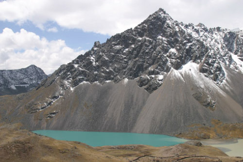
Today, we will follow the Jampamayo River Gorge to a small village of stone houses named Jampa (4650 meters or 15,298 feet). As we head towards Jampa, they valley opens up and gives us our first view of the magnificent “Nevado Tres Picos,” or “3 Picks Mountain” (6093 meters or 19,990 feet). From Jampa, we ascend towards our highest campsite of the trek near the Lakes of Ticllacocha (4800 meters or 15,792 feet).Maximum Altitude: 4800 meters or 15,792 feet
Minimum Altitude: 4650 meters or 15,298 feet
Distance Travelled: 17 km 10.5 miles
Approximate Hiking Time: 6 - 7 Hours
Day 5
Laguna Qomercocha to Pacchanta
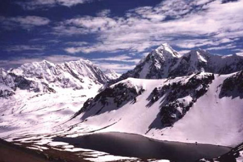
We will start the day by circling around the Lakes of Ticllacocha and climbing 2 hours to the last pass of our trek – Jampa Pass (4950 meters or 16,285 feet). Surrounded by glaciers, huge mountains, and glacial lakes – you will need a moment to take in all the natural beauty. From here, we will start to descend towards our last campsite of the trek – the village of Pacchanta. We will camp near the village and have the chance to visit another refreshing hot springs.Maximum Altitude: 4950 meters or 16,285 feet
Minimum Altitude: 4250 meters or 13,982 feet
Distance Travelled: 15 km or 9.3 miles
Approximate Walking Time: 7 - 8 Hours
Day 6
Pacchanta To Cusco
The last day of our trek is an easy 4-hour walk across open fields. We will enjoy more great views of Mt. Ausangate and make our way back towards the village of Tinqui – completing our circuit around the Ausangate massif. Here, we will say our goodbyes to our trekking team and board our transport back to Cusco where we will arrive around 4 or 5 PM. End of services.Maximum Altitude: 4250 meters or 13,982 feet
Minimum Altitude: 3350 meters 11,021 feet
Distance Travelled: 8 km or 5 miles
Approximate Walking Time: 4 Hours
